MAINE LIGHTHOUSES
|
|
|
| LIGHTHOUSE |
LOCATION |
Open To Public |
Phone # |
Access |
| Baker Island |
Cranberry Isles - Acadia National Park |
No |
207-288-3338 |
OFFSHORE IN ACADIA NATIONAL PARK |
| Bass Harbor Head |
Mount Desert Island, near Acadia National
Park |
Grounds Only |
|
ACADIA NATIONAL PARK/ROUTES 3 AND 102 |
| Bear Island |
Northeast Harbor; Nearest town: Northeast Harbor |
No - best viewed by boat |
|
|
| Blue Hill Bay |
Green Island, Blue Hill Bay; Nearest
town: Brooklin |
No - best viewed by boat |
|
|
| Boon Island |
Off the coast of York; Nearest town: York |
No |
|
|
| Brown's Head |
Northwest end of Vinalhaven Island; Nearest
town: Vinalhaven |
Grounds Only |
|
FERRY FROM ROCKLAND |
| Burnt Coat Harbor |
Hockamock Head, Swans Island; Nearest town: Swans Island |
Grounds Only-Ferry from Bass Harbor |
|
FERRY FROM BASS HARBOR |
| Burnt Island |
Entrance to Boothbay Harbor; Nearest
town: Boothbay Harbor |
public tour and educational program-call
(207) 633-2284 |
207-633-9542 |
BOAT |
| Cape Elizabeth |
Entrance to Casco Bay; Nearest town: Cape Elizabeth |
No |
|
|
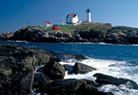
| Cape Neddick |
Cape Neddick, near entrance to York River;
Nearest town: York |
No |
207-363-1040 |
END OF NUBBLE ROAD/YORK BEACH |
| LIGHTHOUSE |
LOCATION |
Open To Public |
Phone # |
Access |
| Curtis Island |
Camden Harbor; Nearest town: Camden |
Sightseeing cruises from Camden Harbor |
207-236-4404 |
BOAT FROM CAMDEN HARBOR |
| Doubling Point |
Arrowsic Island, Kennebec River; Nearest
town: Arrowsic |
Grounds only-sightseeing cruises available |
207-326-4502 |
|
| Doubling Point Front & Rear Range |
Arrowsic Island, Kennebec River; Nearest town: Arrowsic |
No |
207-442-7443 |
|
| Dyces Head |
Mouth of the Penobscot River; Nearest
town: Castine |
Yes |
207-326-4502 |
|
| Eagle Island |
East Penobscot Bay; Nearest town: Deer Isle |
No |
|
|
| Egg Rock |
Entrance to Frenchman Bay - Nearest
town: Winter Harbor |
No |
|
|
| Fort Point |
Mouth of Penobscot River; Nearest town: Stockton Springs |
Yes |
207-567-3356
OR
207-941-4014 |
FORT POINT STATE PARK/FORT POINT ROAD |
| Franklin Island |
Muscongus Bay; Nearest town: Friendship |
No |
207-546-2124 |
|
| Goat Island |
Cape Porpoise Harbor; Nearest town: Kennebunkport, |
No |
|
BOAT |
| Goose Rocks |
Fox Islands Thorofare, Penobscot Bay |
|
|
|
| |
Nearest town: North Haven |
No |
207-734-2253 |
|
| Great Duck Island |
Blue Hill Bay approach; Nearest town:
Frenchboro |
No |
207-288-5015 |
|
| Grindle Point |
Gilkey Harbor, Islesboro; Nearest town: Islesboro |
Yes |
|
FERRY FROM LINCOLNVILLE BEACH |
| Halfway Rock |
Casco Bay; Nearest town: South Harpswell |
No |
|
|
| LIGHTHOUSE |
LOCATION |
Open To Public |
Phone # |
Access |
| Hendricks Head |
Sheepscot River Entrance. Nearest town: West Southport |
No |
|
|
| |
Greens Island, entrance to Hurricane
Sound |
|
|
|
| Heron Neck |
Nearest town: Vinalhaven |
No |
207-367-2261 |
|
| Indian Island |
Rockport Harbor, Penobscot Bay; Nearest
town: Rockport |
No |
|
|
| Isle Au Haut |
Robinson Point. Isle au Haut Thorofare; Nearest town: Isle
au Haut |
Yes |
207-367-2261 |
FERRY FROM STONINGTON |
| Libby Island |
Machias Bay entrance; Nearest town:
Machiasport |
No |
|
|
| |
Little River Island, Cutler Harbor |
|
|
|
| Little River |
Nearest town: Cutler |
No |
207-646-0515 |
|
| Lubec Channel |
Lubec Channel; Nearest town: Lubec |
No |
207-372-6450 |
|
| Mark Island |
Jonesport |
|
207-546-2124 |
|
| Marshall Point |
Entrance to Port Clyde Harbor; Nearest town: St. George |
Yes |
207-372-6450 |
ROUTE 131 SOUTH FROM THOMASTON TO MARSHALL POINT ROAD |
| Matinicus Rock |
About five miles from Matinicus Island,
Penobscot Bay. Nearest town: Matinicus |
Yes |
|
BOAT FROM MATINICUS ISLAND |
| Monhegan Island |
Nearest town: Monhegan |
Yes |
207-596-7003 |
FERRY FROM PORT CLYDE |
| LIGHTHOUSE |
LOCATION |
Open To Public |
Phone # |
Access |
| Moose Peak |
Mistake Island. Nearest town: Jonesport |
No |
|
|
| |
About 20 miles south of Mount Desert Island |
|
|
|
| Mount Desert Rock |
Nearest town: Frenchboro |
No |
207-288-5015 |
|
| |
Pond Island, Narragaugus Bay. Nearest town: |
|
|
|
| Narraguagus |
Milbridge |
No |
|
|
| Nash Island |
Southeast mouth of Pleasant Bay; Nearest town: Addison |
No - best viewed by boat |
207-677-2494 |
|
| Owls Head |
West Penobscot Bay, entrance to Rockland
Harbor; Nearest town: Owl's Head |
Yes |
207-941-4014 |
KNOX COUNTY LIGHTHOUSE PARK/OFF ROUTE
73 |
| Pemaquid Point |
Entrance to Muscongus Bay and John Bay; Nearest town: Bristol |
Yes |
207-677-2494 |
ROUTE 130 |
| Perkins Island |
Perkins Island, Kennebec River; Nearest
town: Georgetown |
Yes |
|
BOAT |
| Petit Manan |
Off Petit Manan Point. Nearest town: Milbridge |
Yes |
207-767-7650 |
PRIVATE BOAT |
| Pond Island |
Mouth of the Kennebec River; Nearest
town: Georgetown |
No |
207-799-2661 |
|
| Portland Breakwater |
Portland Harbor; Nearest city: South Portland |
Yes |
|
"BUG LIGHT PARK" OFF BREAKWATER DRIVE |
| Portland Head |
Portland Harbor / Casco Bay. Nearest
town: Cape Elizabeth |
No: Call (207) 799-2661 |
207-799-2661 |
1000 SHORE ROAD/FORT WILLIAMS PARK |
| LIGHTHOUSE |
LOCATION |
Open To Public |
Phone # |
Access |
| Prospect Harbor |
Prospect Harbor Point. Nearest town: Prospect Harbor |
Occasionally for special events |
|
|
| |
Eggemoggin Reach / Penobscot Bay. |
|
|
|
| Pumpkin Island |
Nearest town: Little Deer Isle |
No |
|
|
| Ram Island |
Fisherman's Passage, Boothbay Harbor |
by appointment; call (207) 882-9721;
cruises leaving Boothbay Harbor |
207-633-4727 |
|
| |
Nearest town: Boothbay Harbor |
Boothbay Harbor |
|
|
| |
Portland Harbor / Casco Bay |
|
|
|
| Ram Island Ledge |
Nearest town: Cape Elizabeth |
No; accessible by boat only |
|
|
| Rockland Breakwater |
Jameson Point, Rockland Harbor. Nearest
city: Rockland |
weekends in summer from 9 a.m. to 6
p.m. Call 207-785-4609 |
207-443-3877 |
END OF BREAKWATER/WALDO AVENUE &
SOMASET ROAD |
| Saddleback Ledge |
Isle au Haut Bay; Nearest town: Vinalhaven |
No - best viewed by boat |
207-799-6337 |
|
| Seguin |
Mouth of Kennebec River; Nearest town:
Georgetown |
Island open to private boaters, cruises
available, lighthouse open for occasional tours. |
|
BOAT FROM BATH, POPHAM BEACH, OR BOOTHBAY
HARBOR |
| Spring Point Ledge |
West side of Portland Harbor; Nearest city: South Portland |
Yes |
207-767-7488 |
BREAKWATER/FORT PREBLE AREA |
| LIGHTHOUSE |
LOCATION |
Open To Public |
Phone # |
Access |
| Squirrel Point |
Arrowsic Island, Kennebec River. Nearest
town: Arrowsic |
No; views available by cruise |
207-733-0911 |
|
| |
Southern Island, Tenants Harbor, Penobscot Bay |
|
|
|
| Tenants Harbor |
Nearest town: Tenants Harbor ( A village
of St. George |
No; best seen by boat |
|
|
| |
Cape Newagen / Booth Bay Approach |
No; best seen by boat; |
|
|
| The Cuckolds |
Nearest City: SOUTHPORT |
sightseeing cruises available |
|
|
| |
Two Bush Channel, Penobscot Bay |
|
|
|
| Two Bush Island |
Spruce Head |
No; best seen by boat |
207-546-2124 |
|
| West Quoddy Head |
Easternmost point in the U.S., Bay of Fundy. Nearest town:
Lubec |
No |
207-733-2180 |
QUODDY HEAD STATE PARK/ROUTE 189 |
| Whaleback |
Portsmouth (New Hampshire) Harbor ; Nearest
town: Kittery |
No |
|
|
| Whitehead Island |
Whitehead Island, Penobscot Bay; Nearest town: St. George |
By special arrangement; best seen by boat |
|
|
| Whitlock's Mill |
St. Croix River; Nearest city: Calais |
No; best seen by boat |
207-454-2604 |
|
| |
Mark Island, Winter Harbor. Nearest town: Winter |
|
|
|
| Winter Harbor |
Harbor |
No; best seen by boat |
|
|
| Wood Island |
Mouth of Saco River; Nearest town: Biddeford Pool |
No; Boat only |
|
|
| LIGHTHOUSE |
LOCATION |
Open To Public |
Phone # |
Access |